The Particular Description of England by William Smith
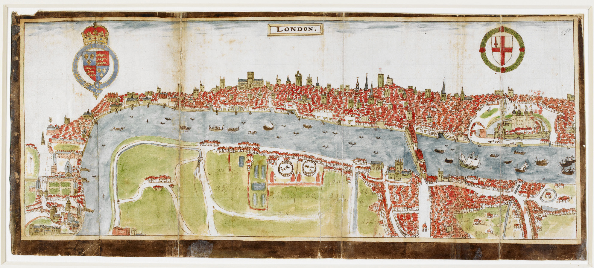
The Particular Description of England by William Smith (Map), 1588Do you need a type of literacy to �read� Google maps? How do you know how to use such visual and verbal depictions of space? Early modern England was relatively newly acquainted with maps. Although they had been around for a long time by the Tudor period, in the years that follow 1550 there was a huge expansion in who could access or own them. They were increasingly bought or made by middling individuals. As many were officeholders in their local communities, like churchwardens, middling individuals had a very keen interest in the geography of their local areas, perhaps more so than the gentry above them.
Middling customers with enough spending money could purchase maps of all kinds, including in expensive but not unattainable �folio� books (large �format volumes). Middling professionals like William Smith sat at heart of the expansion in mapmaking. Smith drew this map of Bristol while touring the country writing an account of local places and features. He was trained in making coats of arms (the drawings of shields or crests given to �noble� families). However, he was a passionate �antiquarian��a term that came to be applied to those interested in local history. He was also interested in what distinguishes different towns and cities across England, and these maps were to be read alongside what we might now regard as his �guide-books.�
He also includes, alongside the maps, the kind of information we would get from a travel app: this volume includes the distances and times it takes to travel from one location to another across the country. Here, his detailed manuscript sketch, with a textual �key,� falls into a recognisable model of the period�s geography. Such images become particularly popular when John Speed�s famous maps from the period became more readily available in print.
| Object Type | Map |
| Year | 1588 |
| Material | Manuscript |
| Owned By | Sloane MS 2596, fo. 52 |
| Keywords | reading; drawing; making; looking; collecting; memory; production; travel; time; visual culture; literacy; print |
| Image Credit | The Particular description of England by William Smith, British Library BL Sloane MS 2596, fo. 52. Shared with permission from British Library. � British Library Board (Sloane MS 2596, fo. 52). |